Map collection and digital map collections
Other digital outputs and projects:
The map collection of the Institute of History of the Czech Academy of Sciences is part of the institute’s library. It was established by the former State Historical Institute in Prague (predecessor to the Institute of History), with development of its catalogue commencing in the 1930s (donations, purchases, exchanges between institutions, estate acquisitions, and – after the Second World War – confiscations). Currently, the collection is not being expanded. Between 1985 and 1991, the collection was sorted, organized, and made available for research purposes, and this work continues today despite the collection having been relocated three times. The collection is currently kept at the headquarters of the Institute of History of the Czech Academy of Sciences, where in 2016 the spaces housing it were completely renovated.
The map collection of the Institute of History of the Czech Academy of Sciences contains cartographic documents dating from the end of the 16th century to the beginning of the 21st century. Presently, the catalogue comprises some 6,250 map units and drawings (including reproductions) and approximately 1,200 atlas units. At the core of the collection are cartographic documents dating from the 18th to 20th century, namely of Czech and Central European provenance. There are general geographic and political maps, detailed topographic map works, town plans, and thematic cartographic documents (transportation, ethnic, demographic, historical, economic, geologic, etc.).
Cartographic documents form an inseparable component of the national cultural heritage. They reflect contemporary geographic and scientific-technical knowledge and creative skills, and their decorative elements reveal the artistic style of the period and the culture of the everyday. They capture the state and transformations of the landscape and, like written, pictorial, or tangible sources, they contribute to a better understanding of the evolution of society within a particular geographic space. The map collection of the Institute of History of the Czech Academy of Sciences is used by scholars and members of the general public conducting research on the historical landscape and cultural, social, and economic phenomena. It provides materials for the preparation of the publication series Historical Atlas of Czech Towns and other historical-geographic endeavours, including the printed Academic Atlas of Czech History (2014) and the project entitled Czech Historical Atlas (2016–2020). The cartographic documents are also widely used for educational and popularization purposes.
The history of the map collection is linked to the largest cataloguing endeavour ever undertaken for the cartographic riches of the Czech lands. Beginning in 1939, the former State Historical Institute began cataloguing cartographic sources connected to the Czech lands kept in important Bohemian, Moravian, Silesian, and Austrian (Viennese) collections. František Roubík used these materials to compile a two-volume publication entitled Soupis map českých zemí 1 a 2 [Map Catalogue of the Czech Lands 1 and 2] (Praha 1951/52, 1955). The card file with approximately 22,000 original cards has survived to the present day and is currently held in the map collection of the Institute of History of the Czech Academy of Sciences. Unfortunately, further use of the file is limited, namely due to the reduced legibility of some of the cards but also because much of the information is now antiquated (particularly information on the location of catalogued documents), thus so is the information in Roubík’s publication. Nonetheless, it remains the only (and to this day much used) attempt to produce a printed central catalogue of the maps of the Czech lands up to the first third of the 20th century.
Public access to the collection
Cartographic documents from the map collection can be searched online in the electronic catalogue; the collection is being continually catalogued. Currently, a substantial part of the catalogue is being digitized and made available to the public online. Making the cartographic works available in this manner not only opens a wide range of possible uses but also protects them as archive and collection materials. The documents from the collection can also be reserved for use in the reading room of the Institute of History library.
The catalogue entries for maps and plans are part of the electronic catalogue of the library of the Institute of History of the Czech Academy of Sciences: http://aleph.lib.cas.cz/F/?func=file&file_name=find-b&local_base=HIUP (we recommend entering MAPS in the format search field).
The electronic catalogue of the atlas collection is available at: http://147.231.23.149/atlasy/
The Institute of History of the Czech Academy of Sciences has collaborated with the Research Institute of Geodesy, Topography, and Cartography to develop a virtual map collection for access to digitized cartographic documents from the map collection of the Institute of History of the Czech Academy of Sciences and other memory institutions in the Czech Republic. It is available at: http://chartae-antiquae.cz/en/ (for advanced searches, use: collection – Institute of History of the Czech Academy of Sciences).
Literature on the map collection
František ROUBÍK, Státní historický ústav a jeho sbírky, ČSPS 58, 1950, pp. 35–48.
Eva SEMOTANOVÁ, Výběrový katalog atlasů. Mapová sbírka Ústavu československých a světových dějin ČSAV, Praha 1989.
Eva SEMOTANOVÁ, Mapová sbírka Ústavu světových a československých dějin ČSAV, in: Rozpravy NTM "Z dějin geodézie a kartografie" 07, Praha 1994, pp. 93–94.
Eva SEMOTANOVÁ, Katalog Mapové sbírky Historického ústavu AV ČR, I. – plány měst, HG 29, 1997, pp. 275–312.
Eva SEMOTANOVÁ – ROBERT ŠIMŮNEK, Lexikon mapových archivů a sbírek, Praha 2000.
Eva SEMOTANOVÁ – ROBERT ŠIMŮNEK, Katalog Mapové sbírky Historického ústavu Akademie věd České republiky do roku 1850, Praha 2002.
Contact
Mgr. Jitka Močičková, Ph.D.
email: mocickova@hiu.cas.cz
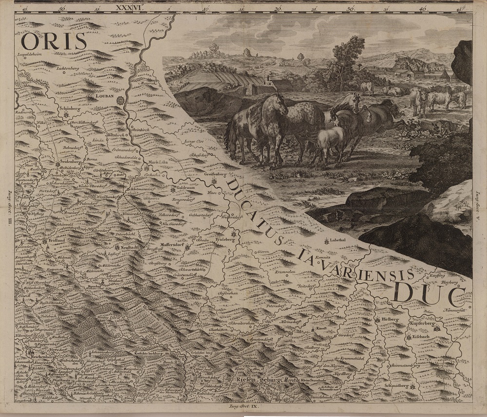
Fig. 1. The region of the Jizera Mountains and Giant Mountains and an example of map ornamentation on Müller’s map of Bohemia (1720). © Map collection of the Institute of History of the Czech Academy of Sciences.
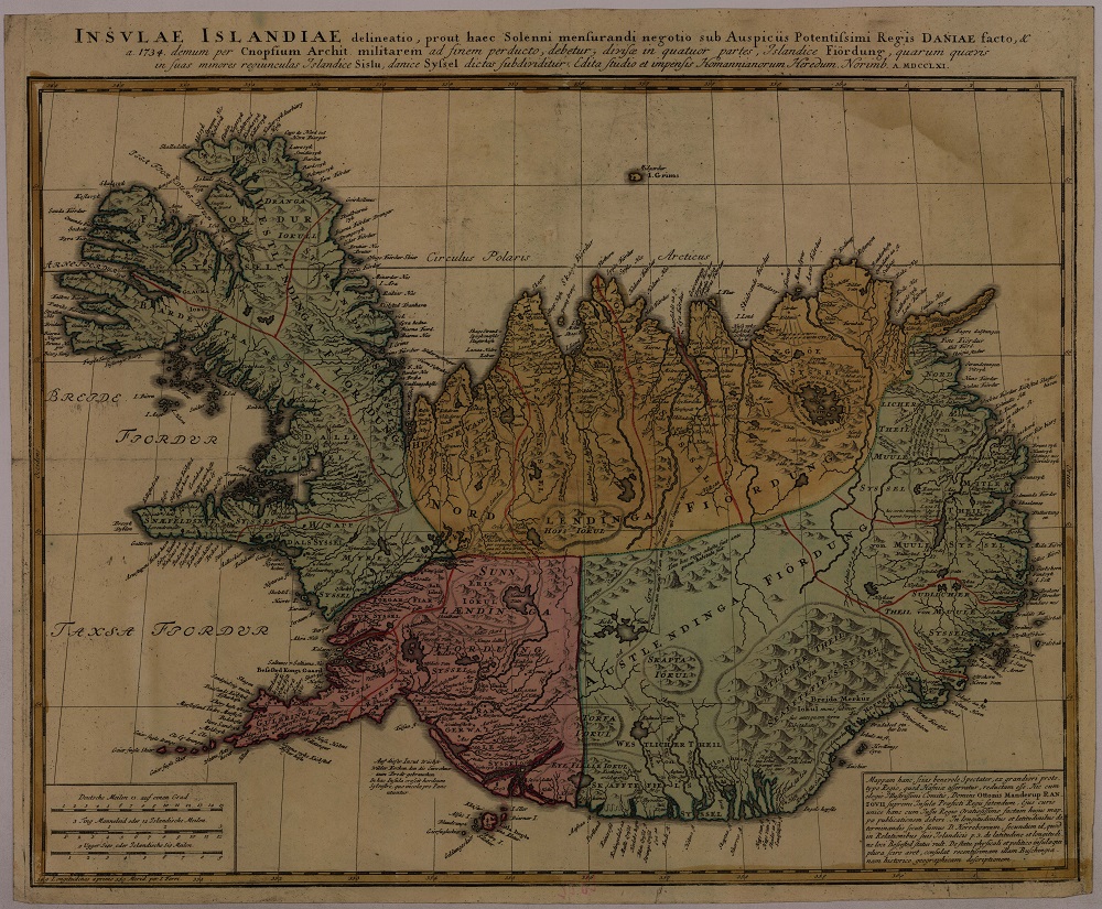
Fig. 2. Map of Iceland from the Nuremberg workshop of Homman Heirs (1761). © Map collection of the Institute of History of the Czech Academy of Sciences.
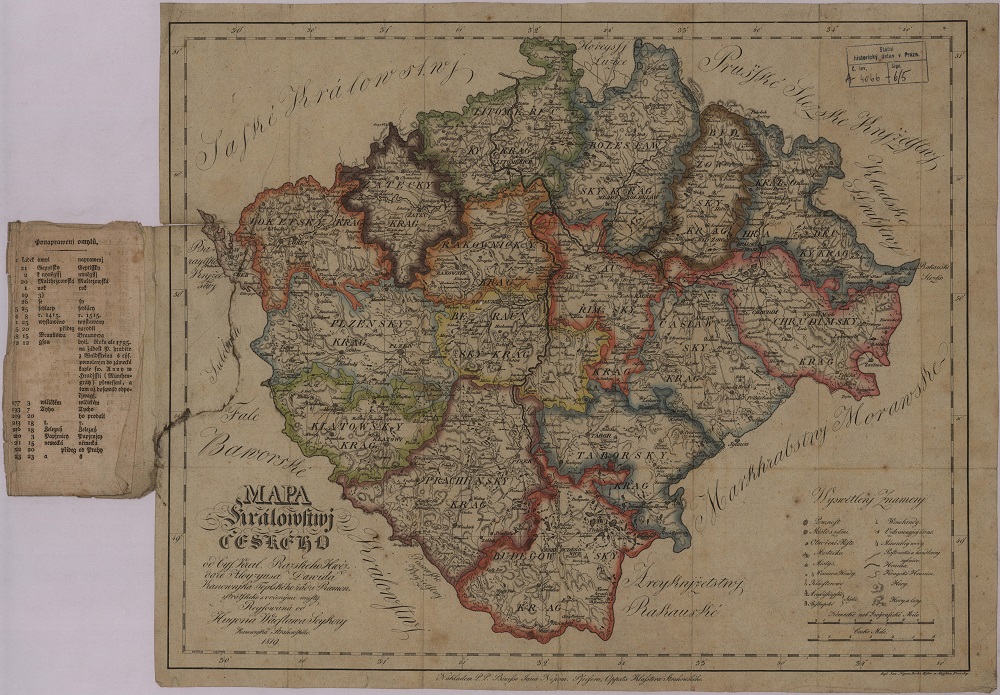
Fig. 3. Czech language map of the Kingdom of Bohemia by Alois Martin David (1819) with regional divisions. © Map collection of the Institute of History of the Czech Academy of Sciences.
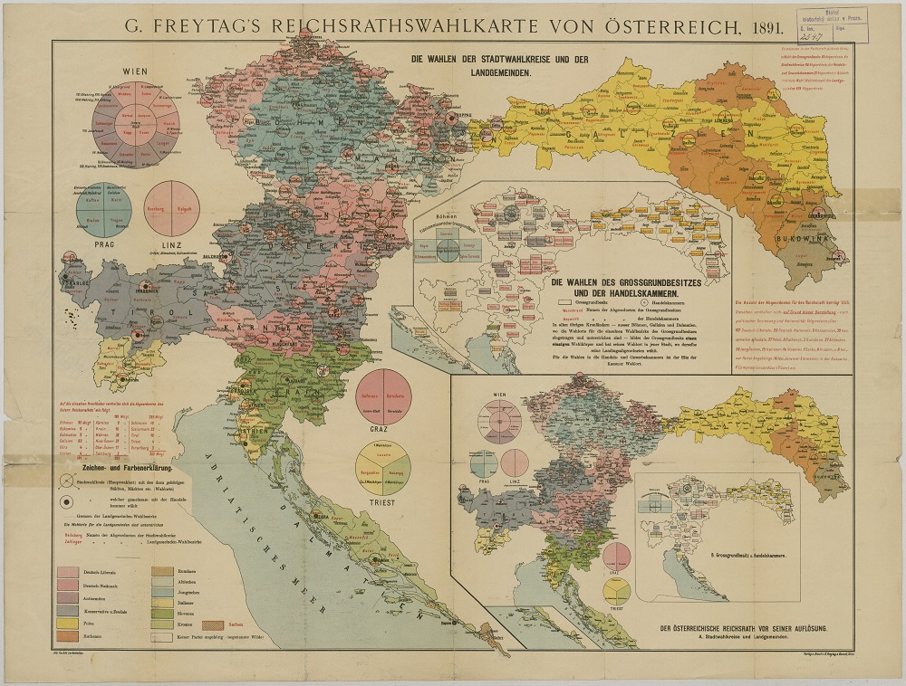
Fig. 4. Freytag Publishing map depicting the results of the elections to the Imperial Council of 1891. © Map collection of the Institute of History of the Czech Academy of Sciences.
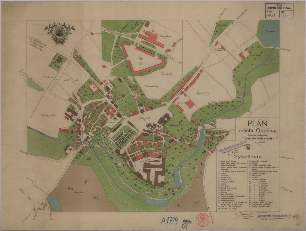
Fig. 5. Plan of the town of Opočno c. 1900. © Map collection of the Institute of History of the Czech Academy of Sciences.
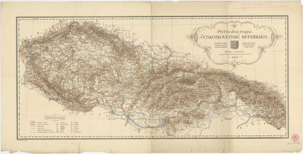
Fig. 6. Map of the Czechoslovak Republic (1920). © Map collection of the Institute of History of the Czech Academy of Sciences.
