Historical Atlas of Czech Towns
 A web portal devoted to the project entitled Historical Atlas of Czech Towns, which, in multiple volumes dating to 1995, uses old maps, vedute, old photographs, aerial photographs, and reconstruction maps and models with textual commentaries to provide scholars and the general public with information on the development of selected urban settlements in Bohemia, Moravia, and Silesia. The individual volumes of the atlas are compiled according to general guidelines for the history of cities and towns set by the European Commission. The portal is gradually publishing the individual volumes, detailed online indexes of maps, plans, and illustrations with pressmarks of the originals kept at memory institutions, colophons, reconstruction maps and selected old plans of the city of Prague. In addition, the portal provides access to map applications, including for other selected urban settlements for which a printed atlas was not feasible due to limited capacity. In order to comply with copyright law, the full map and image materials contained within the published atlases, including texts, are not accessible. The atlas is used in the study of the evolution of the process of urbanization in the Czech lands and the history of towns, in heritage preservation, in the active preservation, recultivation, and formation of the landscape, in educational and popularization activities, etc.
The web portal can be accessed at: http://towns.hiu.cas.cz/en/, printed atlases can be borrowed for use in the reading room without advance reservation.
Contact
Prof. PhDr. Eva Semotanová, DrSc.
email: semotanova@hiu.cas.cz
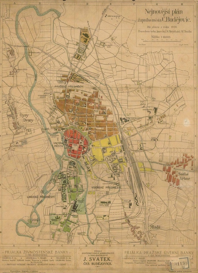
Fig. Plan of České Budějovice as a county city after 1920. © Map collection of the Institute of History of the Czech Academy of Sciences.
